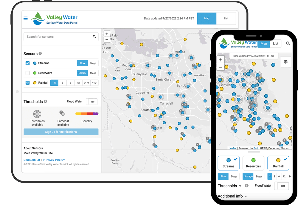
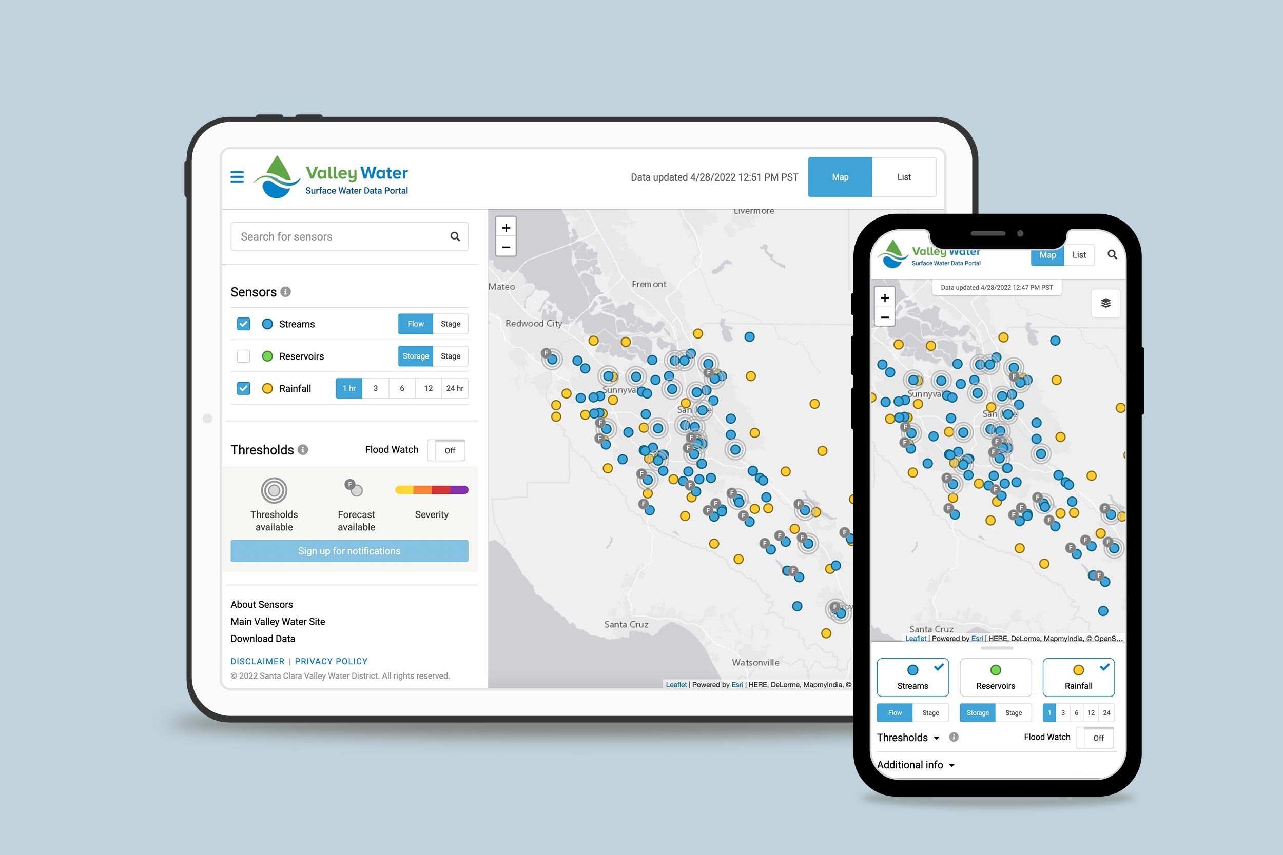
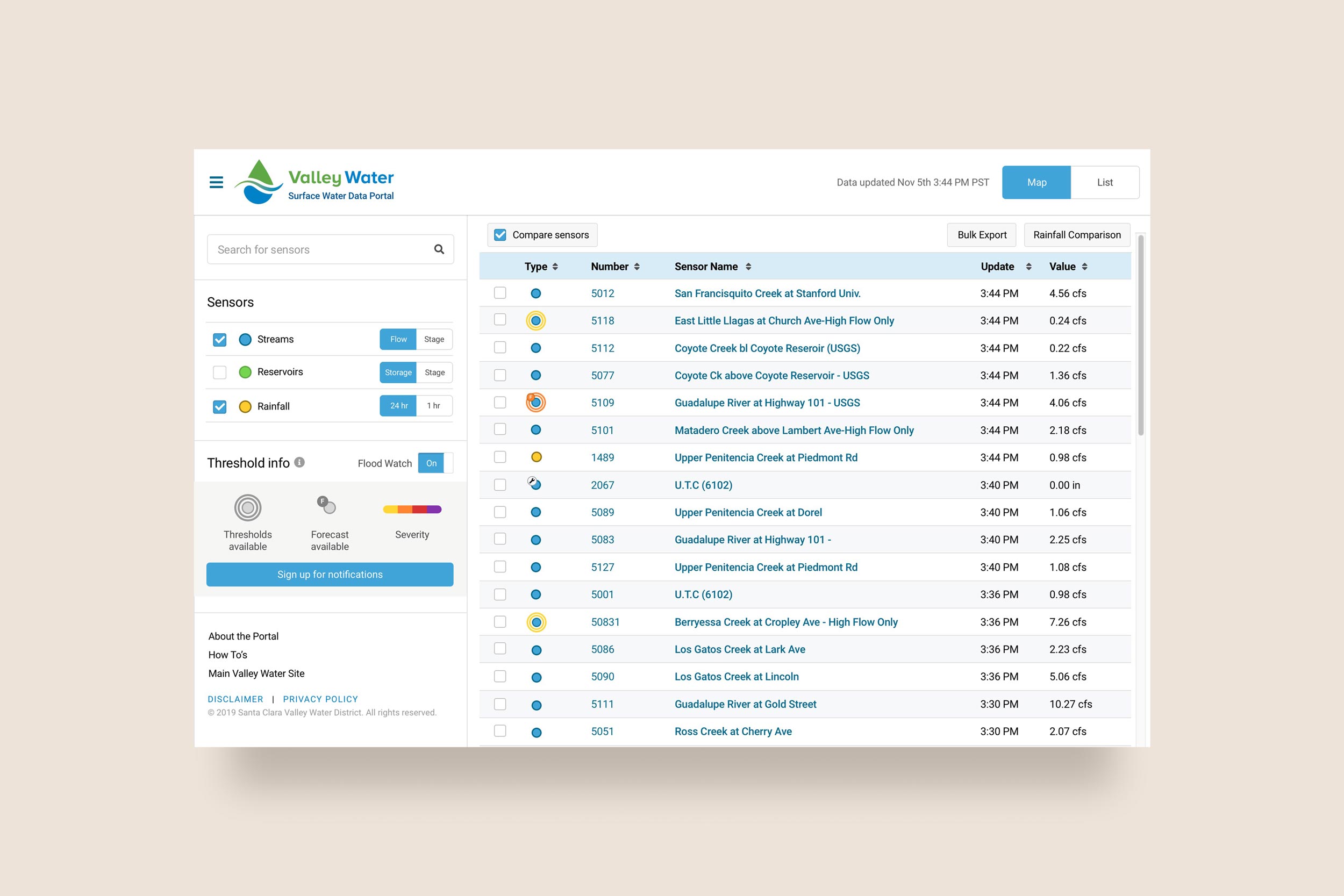
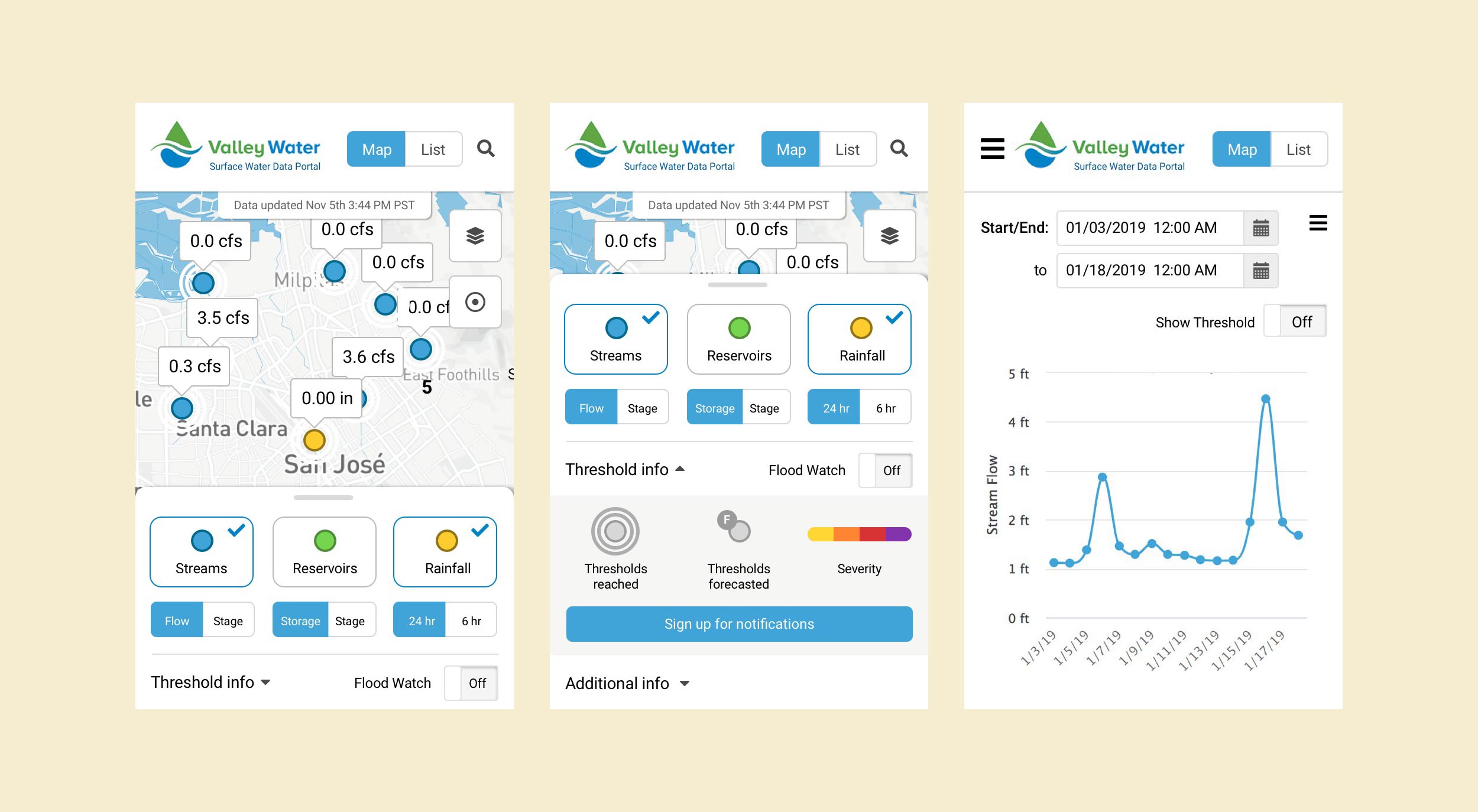
We worked with the Santa Clara Valley Water District to design and build a public-facing surface water data portal that allows visitors to view robust stream, reservoir, and rainfall data from a map interface. The website is highly user-friendly and responsive for mobile devices.
Our surface water data portals are excellent examples of integrating web maps with real time, dynamic data. These projects include robust databases, web API’s, web maps, and external data integration. Raw CSV files from external providers use a shared Dropbox account and workflow for importing data. Data CSV files are imported every hour, sensor data is imported every 15 minutes, and data is immediately available on maps and charts. All data used for the maps, reports, and charts are received from a web APIs.
Visitors can use the site to view real-time sensor data, view flood watch alerts and forecasts, sign up to be notified of flood alerts, and graph and export data.
“Tierra Plan was able to meet our needs in building and designing a map-based webpage displaying GIS features and data. Kevin and his staff are easy to work with and responsive. We were so happy with our original product that we kept them onboard to help expand features and continue maintaining the website."