We worked with the Monterey Peninsula Water Management District (MPWMD) to design and build a modern system for data sharing and visualization. The goals of the project was to:
Make real time and historic sensor data easily accessible to agency staff, partner agencies, researchers, and the interested public.
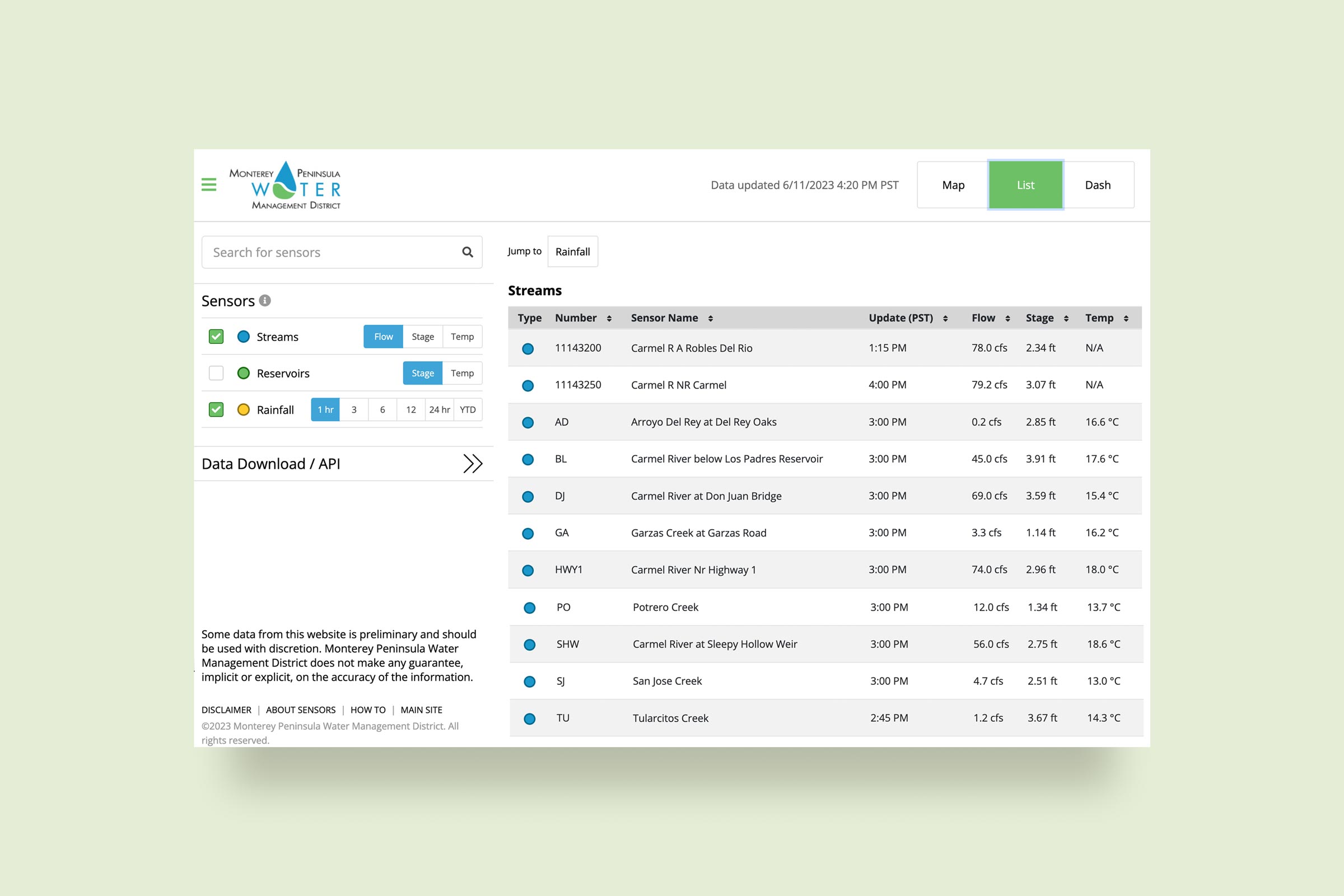
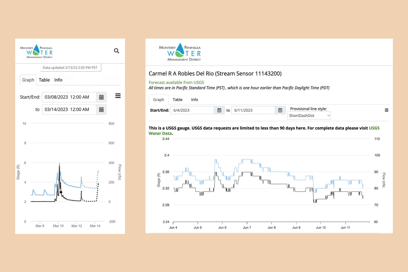
Eliminate manual processes for responding to requests and provide an online tool for downloading data for one or multiple sensors.
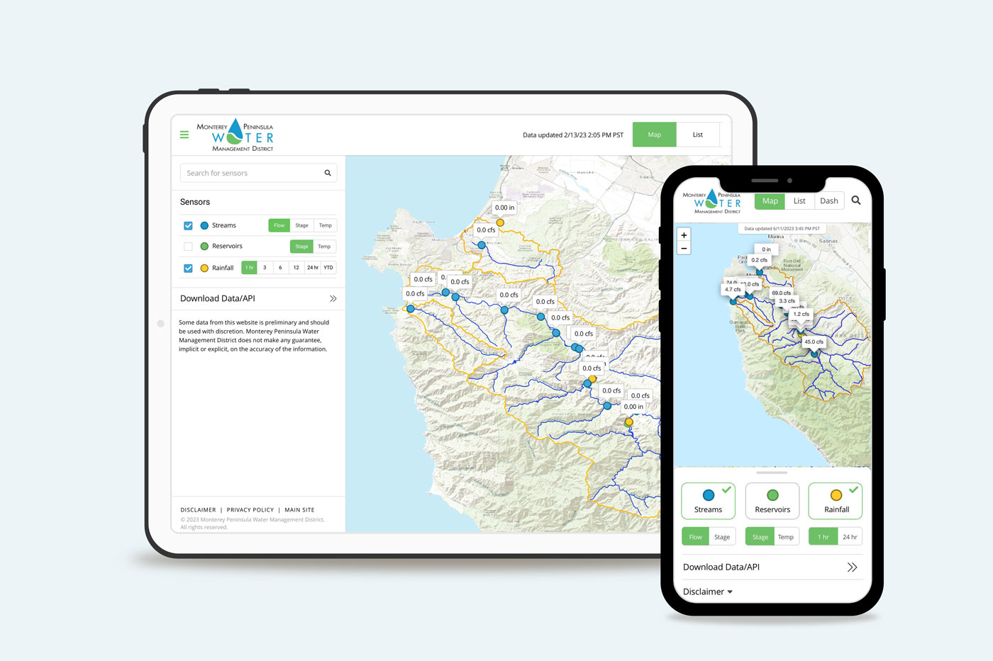
Build a map-based interface for sensors, charts, and data sharing, including real-time, interactive data.
Implement an automated process that extracts data from multiple data collection systems to a central database that can support the web interfaces
We believe in a collaborative and engaging project management approach and worked closely with MPWMD staff throughout the data workflow, interface design, and development processes.
Our sustainable solution meets the following key outcomes:
Informs and engages the public through a simple interactive map and consolidated water data platform.
Is future-proof and highly scalable.
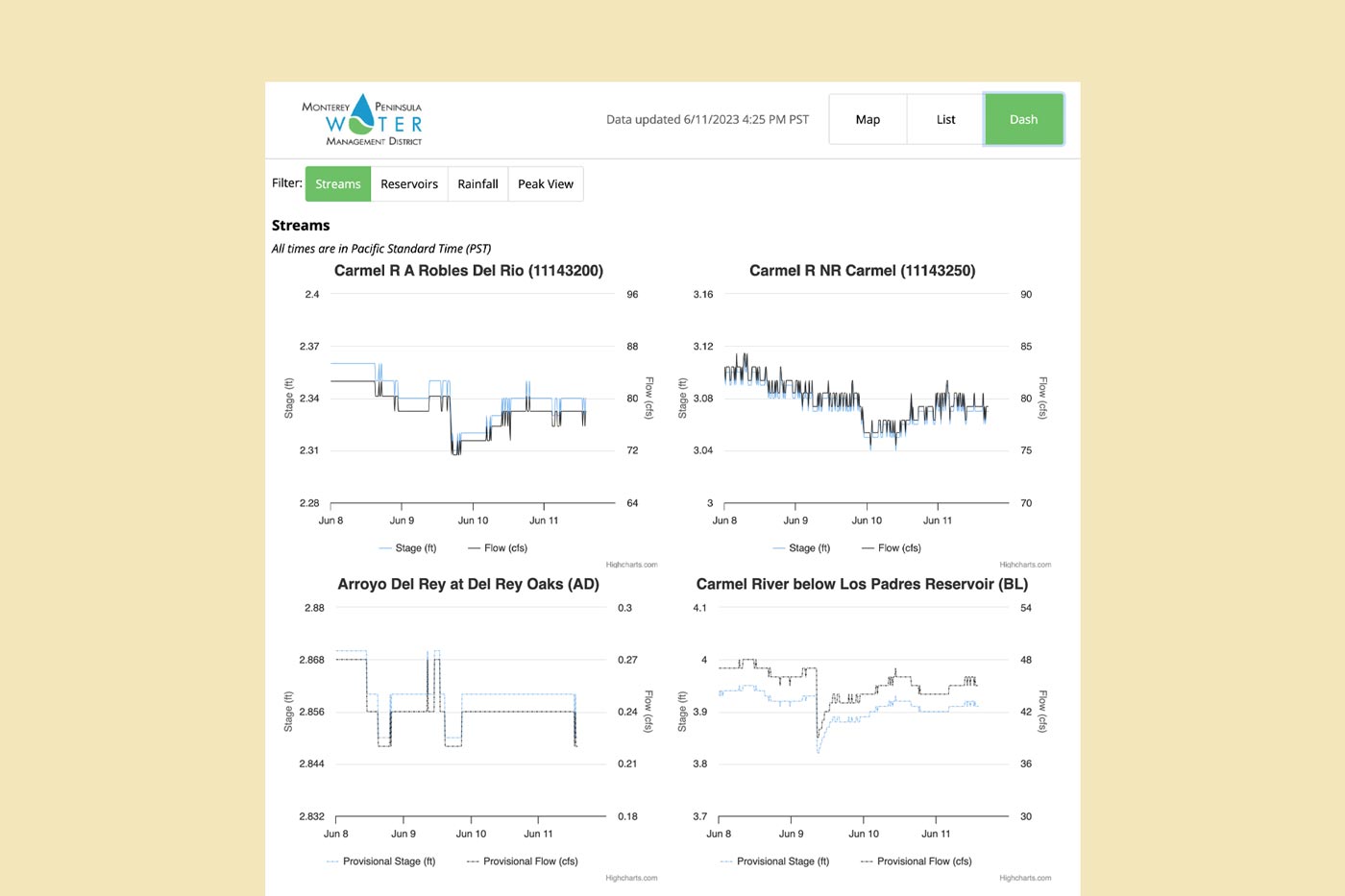
Brings current and historic surface water data to life through maps and graphics.
Increases public participation through an improved user experience.
Includes a dashboard for quick real-time overview of multiple surface water sensors.